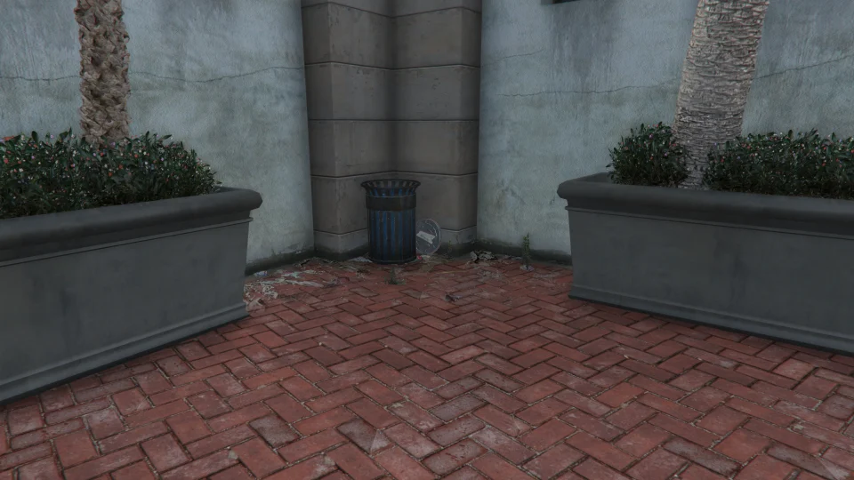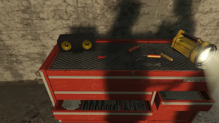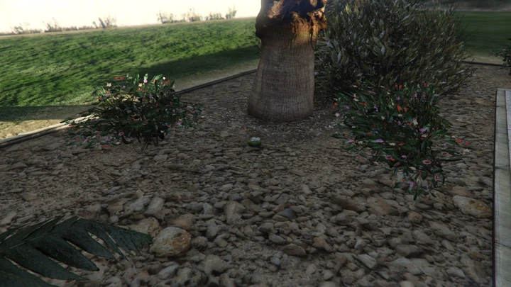
Action Figures are small Impotent Rage toys hidden in everyday places across Los Santos and Blaine County. The set leans heavily on interiors, shelves, garages and tucked-away corners rather than dramatic landmarks.
0 of 100 completed · 0% complete
Los Santos and Blaine County
Los Santos and Blaine County — Action Figures locations and map hints for this area.
Action Figure #1
#1- Figure #
- 1
- Location
- Inside a locker at the back of Devin Weston's hangar at LSIA.
- Setting
- Interior or structure
- District
- Los Santos and Blaine County
- Map hint
- Inside a locker at the back of Devin Weston's hangar at LSIA
Action Figure #2
#2- Figure #
- 2
- Location
- At the back of the Crastenburg sign at the Von Crastenburg Hotel at LSIA.
- Setting
- Elevated or landmark
- District
- Los Santos and Blaine County
- Map hint
- At the back of the Crastenburg sign at the Von Crastenburg Hotel at LSIA
Action Figure #3
#3- Figure #
- 3
- Location
- Inside the small office building at Pier 400, Elysian Island.
- Setting
- Interior or structure
- District
- Los Santos and Blaine County
- Map hint
- Inside the small office building at Pier 400, Elysian Island
Action Figure #4
#4- Figure #
- 4
- Location
- Inside the Bugstars Warehouse, Elysian Island.
- Setting
- Interior or structure
- District
- Los Santos and Blaine County
- Map hint
- Inside the Bugstars Warehouse, Elysian Island
Action Figure #5
#5- Figure #
- 5
- Location
- Inside the checkpoint booth at the entrance to the Los Santos Naval Port.
- Setting
- Interior or structure
- District
- Los Santos and Blaine County
- Map hint
- Inside the checkpoint booth at the entrance to the Los Santos Naval Port
Action Figure #6
#6- Figure #
- 6
- Location
- In a bus wreck inside a rotting storage warehouse at the southernmost part of Murrieta Oil Field.
- Setting
- Interior or structure
- District
- Los Santos and Blaine County
- Map hint
- In a bus wreck inside a rotting storage warehouse at the southernmost part of Murrieta Oil Field
Action Figure #7
#7- Figure #
- 7
- Location
- At the back of a warehouse in Murrieta Oil Field.
- Setting
- Street or open area
- District
- Los Santos and Blaine County
- Map hint
- At the back of a warehouse in Murrieta Oil Field
Action Figure #8
#8- Figure #
- 8
- Location
- East of the Ammu-Nation store in Cypress Flats, near some garage doors.
- Setting
- Interior or structure
- District
- Los Santos and Blaine County
- Map hint
- East of the Ammu-Nation store in Cypress Flats, near some garage doors
Action Figure #9
#9- Figure #
- 9
- Location
- On the base of one of the Rancho Towers in Rancho.
- Setting
- Interior or structure
- District
- Los Santos and Blaine County
- Map hint
- On the base of one of the Rancho Towers in Rancho
Action Figure #10
#10- Figure #
- 10
- Location
- In the office of the LTD Gasoline store in Davis.
- Setting
- Interior or structure
- District
- Los Santos and Blaine County
- Map hint
- In the office of the LTD Gasoline store in Davis
Action Figure #11
#11- Figure #
- 11
- Location
- In Chop's house in front of Lamar's house in Strawberry.
- Setting
- Street or open area
- District
- Los Santos and Blaine County
- Map hint
- In Chop's house in front of Lamar's house in Strawberry
Action Figure #12
#12- Figure #
- 12
- Location
- On a washbasin at a public restroom in Rancho.
- Setting
- Street or open area
- District
- Los Santos and Blaine County
- Map hint
- On a washbasin at a public restroom in Rancho
Action Figure #13
#13- Figure #
- 13
- Location
- In the hobo slum under the freeway in Strawberry.
- Setting
- Street or open area
- District
- Los Santos and Blaine County
- Map hint
- In the hobo slum under the freeway in Strawberry
Action Figure #14
#14- Figure #
- 14
- Location
- Near some decorative items in Simmet Alley, Textile City.
- Setting
- Street or open area
- District
- Los Santos and Blaine County
- Map hint
- Near some decorative items in Simmet Alley, Textile City
Action Figure #15
#15- Figure #
- 15
- Location
- In a booth next to the train tracks in La Mesa.
- Setting
- Street or open area
- District
- Los Santos and Blaine County
- Map hint
- In a booth next to the train tracks in La Mesa
Action Figure #16
#16- Figure #
- 16
- Location
- On a bulldozer plate in the Los Santos Storm Drain in La Mesa.
- Setting
- Street or open area
- District
- Los Santos and Blaine County
- Map hint
- On a bulldozer plate in the Los Santos Storm Drain in La Mesa
Action Figure #17
#17- Figure #
- 17
- Location
- On a shelf inside the El Burro Heights Fire Station.
- Setting
- Interior or structure
- District
- Los Santos and Blaine County
- Map hint
- On a shelf inside the El Burro Heights Fire Station
Action Figure #18
#18- Figure #
- 18
- Location
- On a washbasin at a public restroom near the lake in Mirror Park.
- Setting
- Water or underwater
- District
- Los Santos and Blaine County
- Map hint
- On a washbasin at a public restroom near the lake in Mirror Park
Action Figure #19
#19- Figure #
- 19
- Location
- Inside an auto-opening garage at The Lost MC Clubhouse in East Vinewood.
- Setting
- Interior or structure
- District
- Los Santos and Blaine County
- Map hint
- Inside an auto-opening garage at The Lost MC Clubhouse in East Vinewood
Action Figure #20
#20- Figure #
- 20
- Location
- In the maintenance tunnels, near the entrance in East Vinewood.
- Setting
- Street or open area
- District
- Los Santos and Blaine County
- Map hint
- In the maintenance tunnels, near the entrance in East Vinewood
Action Figure #21
#21- Figure #
- 21
- Location
- In the closed PIllbox North station via the maintenance tunnels, near the train tracks.
- Setting
- Interior or structure
- District
- Los Santos and Blaine County
- Map hint
- In the closed PIllbox North station via the maintenance tunnels, near the train tracks
Action Figure #22
#22- Figure #
- 22
- Location
- On a bench at platform level facing the northbound tracks in the underground Burton Station.
- Setting
- Interior or structure
- District
- Los Santos and Blaine County
- Map hint
- On a bench at platform level facing the northbound tracks in the underground Burton Station
Action Figure #23
#23- Figure #
- 23
- Location
- On the navigational arrow sculpture at the Arcadius Business Center, Pillbox Hill.
- Setting
- Street or open area
- District
- Los Santos and Blaine County
- Map hint
- On the navigational arrow sculpture at the Arcadius Business Center, Pillbox Hill
Action Figure #24
#24- Figure #
- 24
- Location
- On the fountain at the plaza next to the Maze Bank Tower.
- Setting
- Interior or structure
- District
- Los Santos and Blaine County
- Map hint
- On the fountain at the plaza next to the Maze Bank Tower
Action Figure #25
#25- Figure #
- 25
- Location
- In the office inside the LTD Gasoline store in Little Seoul.
- Setting
- Interior or structure
- District
- Los Santos and Blaine County
- Map hint
- In the office inside the LTD Gasoline store in Little Seoul
Action Figure #26
#26- Figure #
- 26
- Location
- At the base of a billboard stand on the south side of Vespucci Canals.
- Setting
- Elevated or landmark
- District
- Los Santos and Blaine County
- Map hint
- At the base of a billboard stand on the south side of Vespucci Canals
Action Figure #27
#27- Figure #
- 27
- Location
- On the northwest side of Vespucci Canals.
- Setting
- Street or open area
- District
- Los Santos and Blaine County
- Map hint
- On the northwest side of Vespucci Canals
Action Figure #28
#28- Figure #
- 28
- Location
- In the mouth of a sculpture of a shark on Vespucci Beach.
- Setting
- Street or open area
- District
- Los Santos and Blaine County
- Map hint
- In the mouth of a sculpture of a shark on Vespucci Beach
Action Figure #29
#29- Figure #
- 29
- Location
- In a rubbish bin at the Pleasure Pier on Del Perro Pier.
- Setting
- Elevated or landmark
- District
- Los Santos and Blaine County
- Map hint
- In a rubbish bin at the Pleasure Pier on Del Perro Pier
Action Figure #30
#30- Figure #
- 30
- Location
- On the railing of a lifeguard tower on Del Perro Beach.
- Setting
- Interior or structure
- District
- Los Santos and Blaine County
- Map hint
- On the railing of a lifeguard tower on Del Perro Beach
Action Figure #31
#31- Figure #
- 31
- Location
- Leaning on a grave at the Hill Valley Cemetery.
- Setting
- Street or open area
- District
- Los Santos and Blaine County
- Map hint
- Leaning on a grave at the Hill Valley Cemetery
Action Figure #32
#32- Figure #
- 32
- Location
- On a table at an Up-n-Atom Burger restaurant on the upper floor of the Del Perro Plaza.
- Setting
- Interior or structure
- District
- Los Santos and Blaine County
- Map hint
- On a table at an Up-n-Atom Burger restaurant on the upper floor of the Del Perro Plaza
Action Figure #33
#33- Figure #
- 33
- Location
- In a trailer near the east entrance of Richards Majestic.
- Setting
- Street or open area
- District
- Los Santos and Blaine County
- Map hint
- In a trailer near the east entrance of Richards Majestic
Action Figure #34
#34- Figure #
- 34
- Location
- Behind some railing in an alleyway in Burton.
- Setting
- Street or open area
- District
- Los Santos and Blaine County
- Map hint
- Behind some railing in an alleyway in Burton
Action Figure #35
#35- Figure #
- 35
- Location
- On the stairs of a building in Downtown Vinewood.
- Setting
- Street or open area
- District
- Los Santos and Blaine County
- Map hint
- On the stairs of a building in Downtown Vinewood
Action Figure #36
#36- Figure #
- 36
- Location
- On the sign of the Hardcore Comic Store in West Vinewood.
- Setting
- Interior or structure
- District
- Los Santos and Blaine County
- Map hint
- On the sign of the Hardcore Comic Store in West Vinewood
Action Figure #37
#37- Figure #
- 37
- Location
- Inside the passageway of a house below pool level on Milton Road, West Vinewood.
- Setting
- Interior or structure
- District
- Los Santos and Blaine County
- Map hint
- Inside the passageway of a house below pool level on Milton Road, West Vinewood
Action Figure #38
#38- Figure #
- 38
- Location
- Next to a tennis court of a mansion on Steele Way, Rockford Hills.
- Setting
- Street or open area
- District
- Los Santos and Blaine County
- Map hint
- Next to a tennis court of a mansion on Steele Way, Rockford Hills
Action Figure #39
#39- Figure #
- 39
- Location
- In the small cave at the Richman Mansion in Richman.
- Setting
- Street or open area
- District
- Los Santos and Blaine County
- Map hint
- In the small cave at the Richman Mansion in Richman
Action Figure #40
#40- Figure #
- 40
- Location
- 6th hole tee box marker on the southern side of GWC and Golfing Society.
- Setting
- Street or open area
- District
- Los Santos and Blaine County
- Map hint
- 6th hole tee box marker on the southern side of GWC and Golfing Society
Action Figure #41
#41- Figure #
- 41
- Location
- At the base of one of the sculptures at the Kortz Center.
- Setting
- Street or open area
- District
- Los Santos and Blaine County
- Map hint
- At the base of one of the sculptures at the Kortz Center
Action Figure #42
#42- Figure #
- 42
- Location
- On a sofa on the upper part of a mansion in Richman.
- Setting
- Street or open area
- District
- Los Santos and Blaine County
- Map hint
- On a sofa on the upper part of a mansion in Richman
Action Figure #43
#43- Figure #
- 43
- Location
- On a lamp at the Parsons Rehabilitation Center in Richman Glen.
- Setting
- Street or open area
- District
- Los Santos and Blaine County
- Map hint
- On a lamp at the Parsons Rehabilitation Center in Richman Glen
Action Figure #44
#44- Figure #
- 44
- Location
- At the small children's playground at the Vinewood Hills Dog Exercise Park, Vinewood Hills.
- Setting
- Street or open area
- District
- Los Santos and Blaine County
- Map hint
- At the small children's playground at the Vinewood Hills Dog Exercise Park, Vinewood Hills
Action Figure #45
#45- Figure #
- 45
- Location
- Near a pool at one of the mansions in Lake Vinewood Estates.
- Setting
- Water or underwater
- District
- Los Santos and Blaine County
- Map hint
- Near a pool at one of the mansions in Lake Vinewood Estates
Action Figure #46
#46- Figure #
- 46
- Location
- At the intake tower of Lake Vinewood.
- Setting
- Water or underwater
- District
- Los Santos and Blaine County
- Map hint
- At the intake tower of Lake Vinewood
Action Figure #47
#47- Figure #
- 47
- Location
- On one of the benches at the Vinewood Bowl.
- Setting
- Street or open area
- District
- Los Santos and Blaine County
- Map hint
- On one of the benches at the Vinewood Bowl
Action Figure #48
#48- Figure #
- 48
- Location
- At the top of the letter N of the Vinewood Sign.
- Setting
- Elevated or landmark
- District
- Los Santos and Blaine County
- Map hint
- At the top of the letter N of the Vinewood Sign
Action Figure #49
#49- Figure #
- 49
- Location
- Next to a pool, behind the mansion at La Fuente Blanca.
- Setting
- Street or open area
- District
- Los Santos and Blaine County
- Map hint
- Next to a pool, behind the mansion at La Fuente Blanca
Action Figure #50
#50- Figure #
- 50
- Location
- Inside the lower part of the Land Act Dam.
- Setting
- Interior or structure
- District
- Los Santos and Blaine County
- Map hint
- Inside the lower part of the Land Act Dam
Action Figure #51
#51- Figure #
- 51
- Location
- On the sign next to the entrance of the NOOSE Headquarters.
- Setting
- Elevated or landmark
- District
- Los Santos and Blaine County
- Map hint
- On the sign next to the entrance of the NOOSE Headquarters
Action Figure #52
#52- Figure #
- 52
- Location
- At the back of the 24/7 at the Tataviam Truckstop.
- Setting
- Street or open area
- District
- Los Santos and Blaine County
- Map hint
- At the back of the 24/7 at the Tataviam Truckstop
Action Figure #53
#53- Figure #
- 53
- Location
- Inside the train control tower near the Palmer-Taylor Power Station.
- Setting
- Interior or structure
- District
- Los Santos and Blaine County
- Map hint
- Inside the train control tower near the Palmer-Taylor Power Station
Action Figure #54
#54- Figure #
- 54
- Location
- In a presumed dog house at a house in the Grand Senora Desert, east of the Redwood Lights Track.
- Setting
- Street or open area
- District
- Los Santos and Blaine County
- Map hint
- In a presumed dog house at a house in the Grand Senora Desert, east of the Redwood Lights Track
Action Figure #55
#55- Figure #
- 55
- Location
- On a shelf next to a large building, south of the Redwood Lights Track.
- Setting
- Street or open area
- District
- Los Santos and Blaine County
- Map hint
- On a shelf next to a large building, south of the Redwood Lights Track
Action Figure #56
#56- Figure #
- 56
- Location
- At a large waste container at the Cherry Pie Farm, Great Chaparral.
- Setting
- Street or open area
- District
- Los Santos and Blaine County
- Map hint
- At a large waste container at the Cherry Pie Farm, Great Chaparral
Action Figure #57
#57- Figure #
- 57
- Location
- At the juice stand at the summit of the Arthur's Pass Trails, Vinewood Hills.
- Setting
- Street or open area
- District
- Los Santos and Blaine County
- Map hint
- At the juice stand at the summit of the Arthur's Pass Trails, Vinewood Hills
Action Figure #58
#58- Figure #
- 58
- Location
- Next to the Abandoned Mine in Great Chaparral.
- Setting
- Street or open area
- District
- Los Santos and Blaine County
- Map hint
- Next to the Abandoned Mine in Great Chaparral
Action Figure #59
#59- Figure #
- 59
- Location
- On a red kayak at the White Water Activity Center in Tongva Valley.
- Setting
- Water or underwater
- District
- Los Santos and Blaine County
- Map hint
- On a red kayak at the White Water Activity Center in Tongva Valley
Action Figure #60
#60- Figure #
- 60
- Location
- At a bar next to the pool at the Pacific Bluffs Country Club.
- Setting
- Interior or structure
- District
- Los Santos and Blaine County
- Map hint
- At a bar next to the pool at the Pacific Bluffs Country Club
Action Figure #61
#61- Figure #
- 61
- Location
- At the back of the Rob's Liquor store in Chumash.
- Setting
- Interior or structure
- District
- Los Santos and Blaine County
- Map hint
- At the back of the Rob's Liquor store in Chumash
Action Figure #62
#62- Figure #
- 62
- Location
- In a large waste container next to the 24/7 store in Chumash.
- Setting
- Interior or structure
- District
- Los Santos and Blaine County
- Map hint
- In a large waste container next to the 24/7 store in Chumash
Action Figure #63
#63- Figure #
- 63
- Location
- At the RON petrol station at the west part of Route 68.
- Setting
- Interior or structure
- District
- Los Santos and Blaine County
- Map hint
- At the RON petrol station at the west part of Route 68
Action Figure #64
#64- Figure #
- 64
- Location
- Near the entrance to the main building at Marlowe Vineyards.
- Setting
- Street or open area
- District
- Los Santos and Blaine County
- Map hint
- Near the entrance to the main building at Marlowe Vineyards
Action Figure #65
#65- Figure #
- 65
- Location
- At the jets statue next to the Fort Zancudo Approach Road.
- Setting
- Street or open area
- District
- Los Santos and Blaine County
- Map hint
- At the jets statue next to the Fort Zancudo Approach Road
Action Figure #66
#66- Figure #
- 66
- Location
- On a tree trunk in the cemetary of the Hill Valley Church in Great Chaparral.
- Setting
- Street or open area
- District
- Los Santos and Blaine County
- Map hint
- On a tree trunk in the cemetary of the Hill Valley Church in Great Chaparral
Action Figure #67
#67- Figure #
- 67
- Location
- Next to a trailer in west Harmony.
- Setting
- Street or open area
- District
- Los Santos and Blaine County
- Map hint
- Next to a trailer in west Harmony
Action Figure #68
#68- Figure #
- 68
- Location
- In the office part of the Los Santos Customs in Harmony.
- Setting
- Interior or structure
- District
- Los Santos and Blaine County
- Map hint
- In the office part of the Los Santos Customs in Harmony
Action Figure #69
#69- Figure #
- 69
- Location
- In the northeast guard tower at Bolingbroke Penitentiary.
- Setting
- Interior or structure
- District
- Los Santos and Blaine County
- Map hint
- In the northeast guard tower at Bolingbroke Penitentiary
Action Figure #70
#70- Figure #
- 70
- Location
- In the control tower at the Sandy Shores Airfield.
- Setting
- Interior or structure
- District
- Los Santos and Blaine County
- Map hint
- In the control tower at the Sandy Shores Airfield
Action Figure #71
#71- Figure #
- 71
- Location
- At the side entrance of a house in northern Sandy Shores.
- Setting
- Street or open area
- District
- Los Santos and Blaine County
- Map hint
- At the side entrance of a house in northern Sandy Shores
Action Figure #72
#72- Figure #
- 72
- Location
- At the back of the Liquor Ace store.
- Setting
- Interior or structure
- District
- Los Santos and Blaine County
- Map hint
- At the back of the Liquor Ace store
Action Figure #73
#73- Figure #
- 73
- Location
- On the back part of a ship next to a house, west of the Sandy Shores Airfield.
- Setting
- Street or open area
- District
- Los Santos and Blaine County
- Map hint
- On the back part of a ship next to a house, west of the Sandy Shores Airfield
Action Figure #74
#74- Figure #
- 74
- Location
- On a toilet at Stab City.
- Setting
- Street or open area
- District
- Los Santos and Blaine County
- Map hint
- On a toilet at Stab City
Action Figure #75
#75- Figure #
- 75
- Location
- In a large rubbish receptacle next to Fort Zancudo.
- Setting
- Street or open area
- District
- Los Santos and Blaine County
- Map hint
- In a large rubbish receptacle next to Fort Zancudo
Action Figure #76
#76- Figure #
- 76
- Location
- In one of the oxidation ponds at the Zancudo Treatment Works.
- Setting
- Street or open area
- District
- Los Santos and Blaine County
- Map hint
- In one of the oxidation ponds at the Zancudo Treatment Works
Action Figure #77
#77- Figure #
- 77
- Location
- Next to some portable toilets in a small building behind the Hookies bar in North Chumash.
- Setting
- Interior or structure
- District
- Los Santos and Blaine County
- Map hint
- Next to some portable toilets in a small building behind the Hookies bar in North Chumash
Action Figure #78
#78- Figure #
- 78
- Location
- Outside the shed on one of the islands in Paleto Cove.
- Setting
- Street or open area
- District
- Los Santos and Blaine County
- Map hint
- Outside the shed on one of the islands in Paleto Cove
Action Figure #79
#79- Figure #
- 79
- Location
- On the lumberjack statue at the Bayview Lodge.
- Setting
- Street or open area
- District
- Los Santos and Blaine County
- Map hint
- On the lumberjack statue at the Bayview Lodge
Action Figure #80
#80- Figure #
- 80
- Location
- Inside the Paleto Forest Sawmill in Paleto Forest.
- Setting
- Interior or structure
- District
- Los Santos and Blaine County
- Map hint
- Inside the Paleto Forest Sawmill in Paleto Forest
Action Figure #81
#81- Figure #
- 81
- Location
- In the small cave below the Altruist Camp.
- Setting
- Street or open area
- District
- Los Santos and Blaine County
- Map hint
- In the small cave below the Altruist Camp
Action Figure #82
#82- Figure #
- 82
- Location
- Inside the tunnel under Mount Chiliad, on the side of the road.
- Setting
- Interior or structure
- District
- Los Santos and Blaine County
- Map hint
- Inside the tunnel under Mount Chiliad, on the side of the road
Action Figure #83
#83- Figure #
- 83
- Location
- At the observation deck atop Mount Chiliad, to the left of the strange mural.
- Setting
- Street or open area
- District
- Los Santos and Blaine County
- Map hint
- At the observation deck atop Mount Chiliad, to the left of the strange mural
Action Figure #84
#84- Figure #
- 84
- Location
- In a large rubbish receptacle next to a house in Paleto Bay.
- Setting
- Street or open area
- District
- Los Santos and Blaine County
- Map hint
- In a large rubbish receptacle next to a house in Paleto Bay
Action Figure #85
#85- Figure #
- 85
- Location
- On the far right of a sill below a shutter in the Clucking Bell Farms in Paleto Bay.
- Setting
- Street or open area
- District
- Los Santos and Blaine County
- Map hint
- On the far right of a sill below a shutter in the Clucking Bell Farms in Paleto Bay
Action Figure #86
#86- Figure #
- 86
- Location
- At the end of a drainage tunnel on Procopio Beach.
- Setting
- Street or open area
- District
- Los Santos and Blaine County
- Map hint
- At the end of a drainage tunnel on Procopio Beach
Action Figure #87
#87- Figure #
- 87
- Location
- On top of a weathered sofa at Dignity Village.
- Setting
- Street or open area
- District
- Los Santos and Blaine County
- Map hint
- On top of a weathered sofa at Dignity Village
Action Figure #88
#88- Figure #
- 88
- Location
- On top of a weathered sofa at Braddock Farm.
- Setting
- Street or open area
- District
- Los Santos and Blaine County
- Map hint
- On top of a weathered sofa at Braddock Farm
Action Figure #89
#89- Figure #
- 89
- Location
- Inside of a tire on the side of an abandoned warehouse in Galilee.
- Setting
- Interior or structure
- District
- Los Santos and Blaine County
- Map hint
- Inside of a tire on the side of an abandoned warehouse in Galilee
Action Figure #90
#90- Figure #
- 90
- Location
- Inside of a Rainé vending machine, in a small entrance area with breakable windows, on the side of Wonderama, Grapeseed.
- Setting
- Interior or structure
- District
- Los Santos and Blaine County
- Map hint
- Inside of a Rainé vending machine, in a small entrance area with breakable windows, on the side of W
Action Figure #91
#91- Figure #
- 91
- Location
- In the opening of a barn at the O'Neil Ranch, Grapeseed.
- Setting
- Interior or structure
- District
- Los Santos and Blaine County
- Map hint
- In the opening of a barn at the O'Neil Ranch, Grapeseed
Action Figure #92
#92- Figure #
- 92
- Location
- Inside of a doghouse at the house near the El Gordo Lighthouse.
- Setting
- Interior or structure
- District
- Los Santos and Blaine County
- Map hint
- Inside of a doghouse at the house near the El Gordo Lighthouse
Action Figure #93
#93- Figure #
- 93
- Location
- On top of a wooden post on the front porch of a house in Catfish View.
- Setting
- Street or open area
- District
- Los Santos and Blaine County
- Map hint
- On top of a wooden post on the front porch of a house in Catfish View
Action Figure #94
#94- Figure #
- 94
- Location
- On a shelf inside a small train car repair shed in the San Chianski Mountain Range.
- Setting
- Interior or structure
- District
- Los Santos and Blaine County
- Map hint
- On a shelf inside a small train car repair shed in the San Chianski Mountain Range
Action Figure #95
#95- Figure #
- 95
- Location
- On the front porch of Maude's trailer in Grapeseed.
- Setting
- Street or open area
- District
- Los Santos and Blaine County
- Map hint
- On the front porch of Maude's trailer in Grapeseed
Action Figure #96
#96- Figure #
- 96
- Location
- On the hood of a beater Regina at Beam Me Up, Sandy Shores.
- Setting
- Street or open area
- District
- Los Santos and Blaine County
- Map hint
- On the hood of a beater Regina at Beam Me Up, Sandy Shores
Action Figure #97
#97- Figure #
- 97
- Location
- Inside the 'U' on the Humane Labs and Research sign.
- Setting
- Water or underwater
- District
- Los Santos and Blaine County
- Map hint
- Inside the 'U' on the Humane Labs and Research sign
Action Figure #98
#98- Figure #
- 98
- Location
- On the desk in the control center at Davis Quartz.
- Setting
- Street or open area
- District
- Los Santos and Blaine County
- Map hint
- On the desk in the control center at Davis Quartz
Action Figure #99
#99- Figure #
- 99
- Location
- On top of a plane fuselage in Thomson Scrapyard in the Grand Senora Desert.
- Setting
- Street or open area
- District
- Los Santos and Blaine County
- Map hint
- On top of a plane fuselage in Thomson Scrapyard in the Grand Senora Desert
Action Figure #100
#100- Figure #
- 100
- Location
- Inside the door of a plane wreck in Thomson Scrapyard, next to the previous action figure.
- Setting
- Interior or structure
- District
- Los Santos and Blaine County
- Map hint
- Inside the door of a plane wreck in Thomson Scrapyard, next to the previous action figure
Sweep by district and check interiors before moving on. Stores, workshops, offices, beaches, farms and tunnels all hold figures, and many are placed just off the main path at counter height or on a high shelf. The landmark sentence is the key detail: broad district names alone will miss counter and back-room placements. The collection is a freeroam hunt tracked across the state, with a completion reward once the full set is turned in.
FAQ
Are figures tied to missions?
No. They are a freeroam collectible that can be approached in any order.
Indoors or outdoors?
Both. The set mixes shops and garages with yards, beaches and tunnels.
What helps with a clean sweep?
Read the landmark sentence before leaving a district, and check high shelves and back rooms you might otherwise skip.